The Greenway” is a leisurely and pleasant walk between Colonno and Cadenabbia following traces of the Antica Strada Regina, the antique connection road was built by the Romans. This 10 km long itinerary leads through ancient villages with wonderful examples of architecture, along villas and gardens with charming views.
See: http://www.lakecomo.it/sites/default/files/allegati/sezione/The%20Greenway.pdf for map and description.
The hike, or more appropriately walk, to San Martino is relatively short at about 45 minutes up from Griante, or about 1 hour up from the shore of Lake Como. The views of Lake Como here are the best of anywhere on the Lake. Seebelow for directions.
From Griante follow the signs and the path that takes you to the Church of San Martino. When you are approximately half way up you will see a path that veers to the left. It will traverse the mountain in a southerly direction until it eventually heads up. Continue until you reach the final ascent, a long and steep field that has a few small buildings at the top of it. From there continue up and to the north to get to Sasso San Martino. (If you take the path that traverses and rises the mountain in a southerly direction you will be taken to Nava instead). You will do a small descent before heading back up. You will come across some old military trenches and you will eventually see over the mountain and down to Menaggio and the northern section of Lake Como. Return the same way. There is a small spring on the way up that provides some water for cooling down, but to be safe bring plenty of drinking water and some snacks. You may see goats.
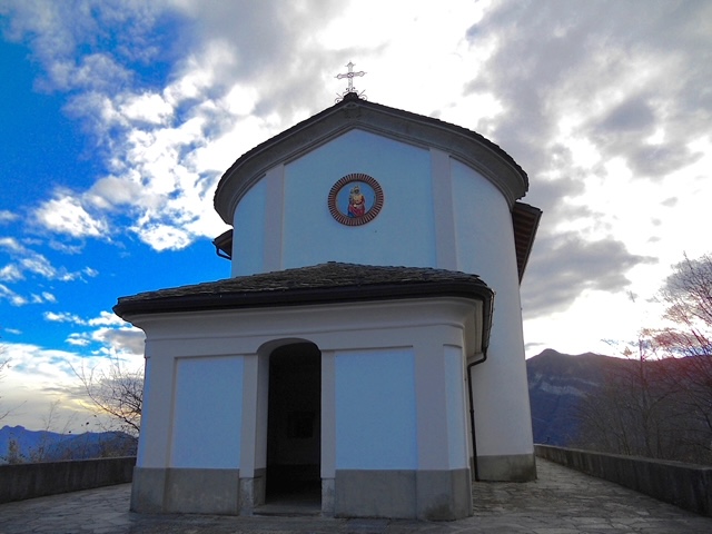
Located in Breglia (780m), 7 km from Menaggio, it offers visitors a spectacular view of central Lake Como and the Bellagio peninsula. Inside there is a sculpture of the Madonna, carved in marble.On the original site of The Sanctuary of Madonna di Breglia there was a small ancient chapel which in 1750 was enlarged to accommodate the increasingly numerous faithful. Inside there is a sculpture of the Madonna, carved in marble. Along the path that leads to the Sanctuary, there are 14 stations in granite representing “The Mysteries of the Rosary”.From principal road you can arrive at the Church in 15 minutes and from there you can enjoy a spectacular view on Lake Como and the surrounding mountains. Continuing throughout the woods you can do a pleasant walk to the small Chapel of San Domenico where you can enjoy an even more spectacular panorama. From there you can descend back down to your starting point.Total time for the hike is about 1 hour. You can get to Breglia by public transit from Menaggio (line C13).

A gentle hike to the small chapel of San Domenico (800m) which rewards you with a spectacular view of Lake Como and the surrounding mountains. The hike starts from the town of Breglia. From the parking lot, or from the bus stop, near the church of San Gregorio, there is a wide and comfortable path that wraps around the mountain side through a forest to the chapel. From the chapel enjoy the spectacular views.
Continue on through the woods and a pasture to the steps of the Santuariodella Madonna di Breglia. From there you can descend back down to your starting point.Total time for the hike is about 1 hour.
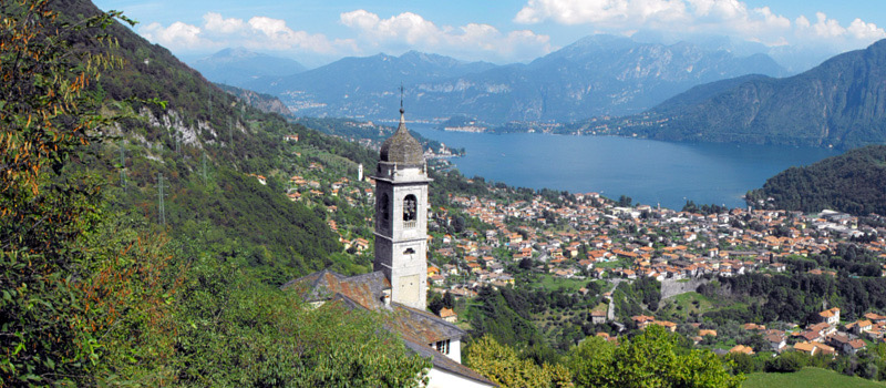
This sanctuary is part of a series of shrines along a one kilometer cobble stoned walkway. The shrines depict scenes of the Madonna’s and Christ’s life and are represented by frescos and natural size statues made of stucco and terracotta. The statues were created between 1635 and 1714 by various artists of Como and the Ticino area. You ascend the Via Crucis, with stops at the shrines to admire the statues, on to the Sanctuary.According to devotional tales, the sanctuary was built because of the discovery of a marble statue of the Virgin Mary and Christ Child in a cave by a deaf mute shepherd girl. During the 15th century a small shrine was built to protect the statue that was believed to be miraculous. The small shrine was first enlarged and then transformed into a church. The central part was completed in 1537. The Sacro Monte has been registered since 2003 on the list of the Humanity World Heritage.
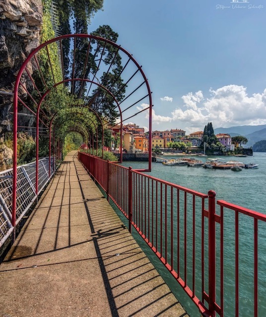
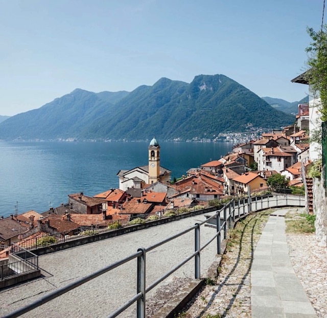
The walk of lovers is a short pedestrian path cantilevered over water in Varenna. It affords romantic views of Lake Como, the mountains, and the small village with its colourful houses perched at the foot of the cliff which is crowned at the top by the Castello di Vezio. The red fenced promenande in Varenna, with its steep alleys and quaint corners attracts lovers from all around the world.
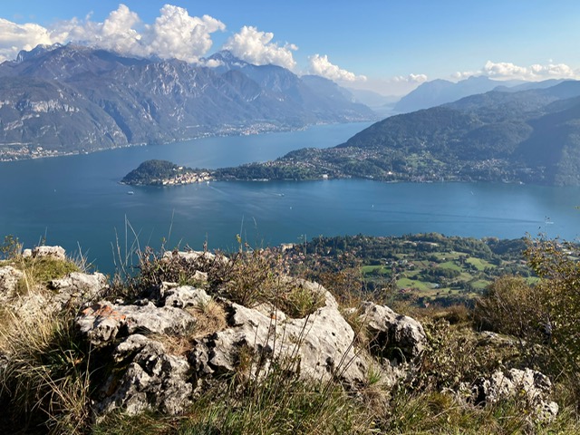
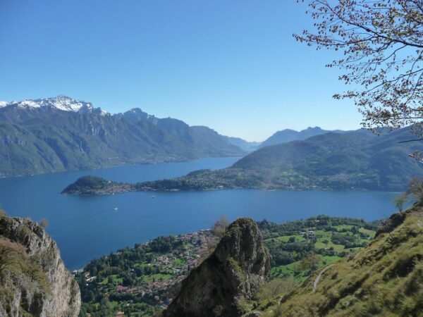
Monti di Nava (850m), also referred to simply as Nava, is an area of alpine pastures in the mountains above Griante and at the foot of Monte Crocione. It was traditionally used for grazing animals such as cows and goats during the summer months, and although you will still find the occasional animal feeding in the meadows, the few stone barns in Nava have been tastefully converted into small summer homes. This cluster of homes and barns is referred to as Bocchetta di Nava.If you enjoy walking in the mountains, then the Monti di Nava are worth visiting for the beautiful views of Lake Como offered up not only when you arrive, but all the way up. To reach Nava you can start directly from the Menaggio Golf Club: just outside the main gate of the golf club take the road on the right and start walking in direction to Monte Crocione and Monti di Nava. It is possible also to startfrom Griante.Both these routes form part of the Via dei Monti Lariani a 125 km trail that runs through the mountain pastures on the west side of Lake Como, anciently known as Lario. Hiking to Monte Crocione (1,400 m) is long and arduous. If you have the time and the inclination, you can also hike for few more minutes up the left (or north) side of Nava to get better views and also maybe find the BochdellaRodella , a cave or crevasse in the mountain that drops back down to about the level of the lake.
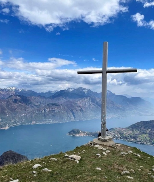
Crocione in Italian means large cross, and that is what adorns the top of Monte Crocione, a 1641 metre peak directly above the town of Griante. From here you will experience breathtaking views of Lake Como, and the Swiss and Italian Alps.
For more information about the routes to Crocione visit Griante.com.
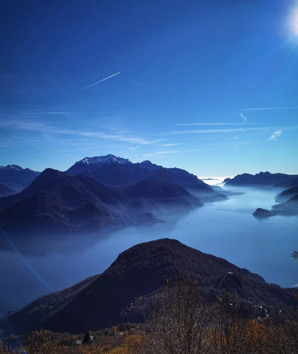
Situated above the town of Menaggio; from RifugioMenaggio you can reach the top of Monte Grona (1736 m) from where one can admire one of the best views of the Pre-Alps; if the day is clear enough, many peaks of the Alps from Monviso to Bernina. From here you also can admire a spectacular views on Lake Como, Lake Piano and Lake Lugano. Starting from Breglia. From the bus stop at Breglia (749 m) cross the road and ascend the small road leading up to Monti di Breglia (sign indicating RifugioMenaggio). At the second bend, just beyond the fountain, you find the first shortcut to the right (sign Monti di Breglia/RifugioMenaggio). The steep trial ends up on the road again, which you cross to pick up the next shortcut. After 20m, at the high tension must turn right. The steep trail leads on the road once more, wich you follow for about 300m. Then you find the next shortcut to the left which leads across a field. Cross the road another time and follow the trail through the woods wich leads on the road at Monti di Breglia (996 m.)After another 100 m you reach a picnic area with fountain and beautiful views; here you leave the road and follow the trail over some rocks up to the left (sign). Once on this trial you continue to follow the signs> You reach a open space used as parking area which you cross and then pick up the trial to the left. At the junction where you find the metal trail sign we reccomended the “Sentiero Alto” to the right because of the better view (after heavy snow fall we reccomended the “Sentiero Basso” to the left. It leads among birch trees and broom up to the junction forS.Amate and Monte Bregagno; at this junction you keep to the left. The now even trail leads along the slope and you soon reach the rifugioMenaggio.
Via Normale
time: 1.30 hrs., ascent: 336m; the beginning of this trial (the easier) is behind the rifugio. It leads up to the “Forcoletta” and from there to the left a steep rocky trail leads to the top.
Via Direttissima
time:1.15 hrs.; ascent 336m; the beginning of this trial is behind the rifugio. The steep trail winds up the south face of the mountain. During the winter this trial, as it is exposed to the south, remains snow covered less time compared to the Via Normale on the north side of the mountain.
Via Ferrata
(Only for alpinists with adequate equipment) Time: 3 hrs. In order to reach the beginning of the Via Ferrata you follow part of the Via Panoramica.